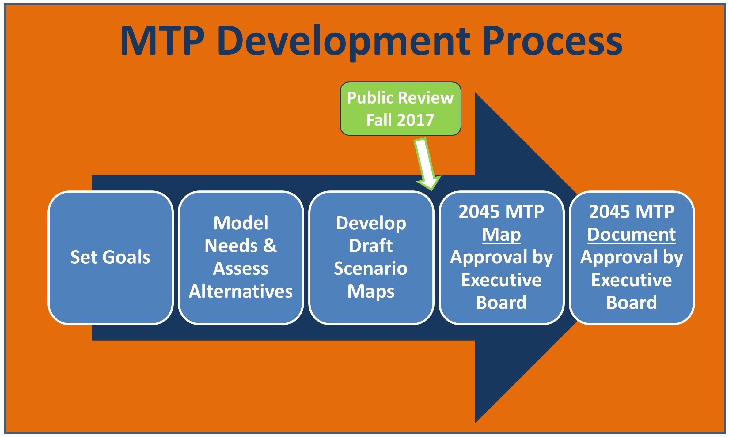
2045 MTP Development
ARCHIVED - The 2045 MTP is not CAMPO's latest plan. Visit the Transportation Plan webpage to find the latest.
Process
The MTP takes approximately 18 months to update, and generally occurs every 4-5 years. The following outlines the steps in the update process.

I. Setting Goals
II. Deficiency Analysis & Alternatives Assessment
- Modelling
- Existing + Committed (E+C) Deficiency Analysis
- Moderate Scenario
- Aspirational Scenario
- Volume/Capacity Maps
- DRAFT 2045 Map (Modeled Scenarios) – Interactive
III.A. Develop Updated Draft Scenarios - Fall 2017
PDF Maps
- DRAFT 2045 Roadways Map (Traditional Funding Scenario)
- DRAFT 2045 Roadways Map (Additional Funding Scenario)
- DRAFT 2045 Transit Map
- DRAFT 2045 Bicyle/Pedestrian Map
- DRAFT 2045 Project List (Traditional/Additional Funding Scenarios)
III.B. Public Comments Received
Following development and presentations to the Executive Boards of a preferred scenario for roadways, transit, and bicycle/pedestrian elements, a final phase of public outreach began in the fall of 2017 to inform and consult with members of the community on the scenario, in particular. Staff from the MPO:
- Attended 10+ public meetings or events to conduct outreach activities
- Websites were regularly updated,
- Facebook, LinkedIn, and Twitter posts were repeatedly sent (Facebook campaign reached 11,500+ people),
- Multiple emails were sent to community contacts, including local media outlets, and,
- Several community partners shared information (RTA, RTP, GoTriangle, GoRaleigh, Member Jurisdictions).
- Draft MTP 2045 Public Information Sheet
- Public Comments Received - October-December, 2017
- Verbal Comments Received at Events
IV. Project Maps and Lists Approved by CAMPO's Executive Board
In February 2018, the Executive Board officially adopted the 2045 MTP. In the months that followed, CAMPO and DCHC MPO staff ran analyses on air quality impacts based on the approved projects list.
In January 2019, the Executive Board approved Amendment #1 with an updated list of Roadways Projects.
Demand Modelling
As part of the 2045 MTP process, Capital Area MPO, DCHC MPO, GoTriangle, and NCDOT have developed an updated version of the Triangle Regional Travel Demand Model (TRM v6).
The information in this document summarizes the major elements of the socioeconomic forecasts for different portions of the area covered by the region's transportation model (TRM). The estimated 2013 and forecasted 2045 population and employment are key inputs into the TRM, which generates importation travel demand information. For forecast data, the MPO uses a land use modeling process called CommunityViz that uses county-level 2045 guide totals and effectively distributes the population and employment growth across the region.
Explanation of the Fall 2017 Draft 2045 MTP Scenarios - "Traditional" and "Additional"
The vast majority of streets, freeways, interstates in the Triangle area are managed by the North Carolina Department of Transportation (NCDOT), with the bulk of funding for improvements and maintenance traditionally coming from state and federal sources.
In the fall of 2017, two maps were under consideration by the CAMPO Executive Board, and available for public comment. The Traditional Funding Map programs transportation improvements based on the amount of funding that is likely to be available over the next 30 years from traditional state and federal funding resources.
In order to provide more improvements to address the forecasted needs on roadways, additional, new, local and regional funding sources would have to be identified and implemented over time. The Additional Funding Map programs transportation improvements assuming the traditional state and federal resources as well as additional local and regional funding is identified. With additional funding, secondary roads would experience a significant increase in projects (less emphasis placed on high volume or multi-lane roadways as in the traditional model). Additional local and regional funding can only be approved in the plan by the Executive Board if there is a reasonable expectation of the additional revenue. An example of this would include the ½ cent transit sales tax recent implemented in Wake County.
